FLATHUNTER / ANDROID · FINDING A HOME
FlatHunter
I built FlatHunter to plan a rental-search walk and keep track of the streets already covered. It suggests areas to investigate; it does not have a live list of available flats.
I wanted to keep track of where I had already looked for a flat.
A rental search can begin before there is a reliable list of available homes. Choosing which areas to cover can turn into repeated walks, while ordinary search does not show which parts of a neighbourhood have already been reached.
The map helps me plan where to walk next.
Start from your workplace, current location or an area you choose on the map. Set how far you want to search and whether you want a room in a gated property or a separate one-room home with a kitchen. The map suggests areas to investigate and remembers your walking route. You can paste listing details to add rent, deposit and room information.
I kept suggested search areas separate from places I had visited.
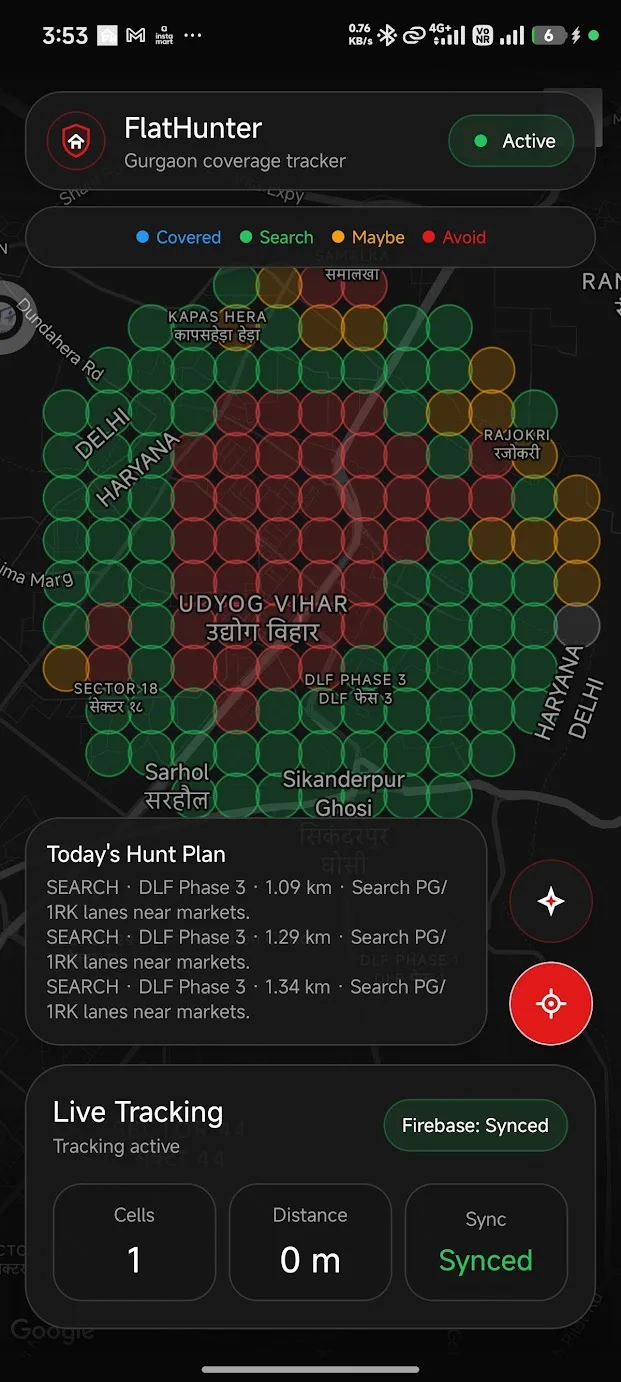
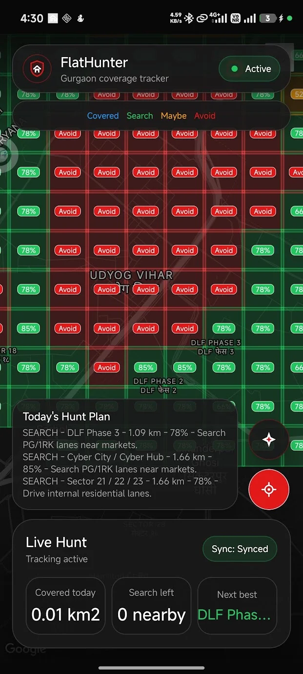
I designed the Android workflow around two questions: where to look and which ground I had already covered. A 450-metre planning grid weighs local map and manually added listing signals; a 100-metre trail records movement. A promising area is not the same thing as a property, or a street already checked.
The suggestions apply to areas I can investigate on foot.
I divided the map into 450-metre squares and used map features and manually added listing details to suggest where to look. Nearby-place lookups still need a field test. A suggestion gives me somewhere to investigate; it cannot tell me that a particular home is available.
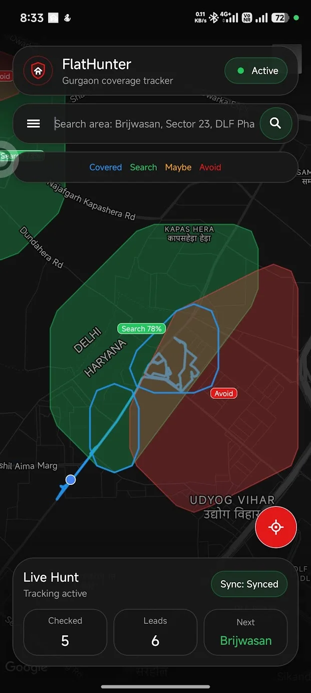
The route history remembers where I have already walked.
GPS routes and 100-metre cells remember where a search has already reached. That trail stays useful even when an area has too little evidence for a confident label.
An area stays Unknown when there is not enough information.
Unknown is a real result. The prototype can narrow the next walk, but it cannot establish whether a property is available, suitable or worth renting.
HOW IT STARTED
Three clues were the beginning.
Markets, schools and gyms suggested places where people might live nearby. Overlapping their catchments was my first idea for narrowing the walk.
The app builds on this idea with a weighted grid that includes land use and other amenities.
Three clues overlaid. Their overlap narrows the search area.
IN PRACTICE
Where you can use it and how I built it.
Where it can help
- Plan a rental-search walk in an unfamiliar area.
- Return to a neighbourhood without repeating the same covered ground.
- Compare Search, Maybe, Avoid and Unknown areas before choosing the next walk.
Built with
 Kotlin
 Android
 Google Maps
 OpenStreetMap
- Kotlin / Android
- Phone interface, location and local route history.
- Google Maps & Places
- Map display and nearby-place signals for the search plan.
- OpenStreetMap
- Land-use and place signals in the planning grid.
Area labels help plan a walk. Actual availability still depends on visiting the property.